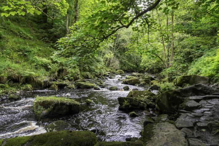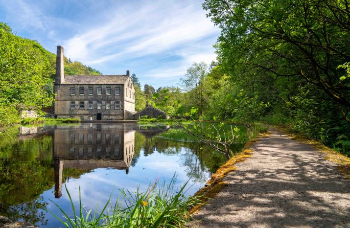
A woodland riverside walk in Hardcastle Crags, Nr Hebden Bridge, West Yorkshire.
This is a really nice well trodden route where there will be plenty of opportunity to take photos in a number of different styles and have a cuppa and a piece of cake or an ice cream at the Historic 19thC Gibson Mill at the halfway point. The route starts and ends at Midgehole National Trust lower level Car Park on the edge of the woods.

Gear: This is dependent on the weather which, for the time of year, should be good but Calderdale has its own microclimate so it can be changeable. I suggest you include:
- Suitable walking boots
- Light waterproofs
- Layers
- Snacks and water. This will run over lunchtime but some pubs and cafes in Hebden Bridge serve throughout the day (for post-walk food).
- Camera equipment as necessary, including tripod in view of the lower levels of lighting.
Opportunities: There will be a chance to use a number of different ways to capture the natural beauty of the woodland. For example the capture of river and other wildlife, flora and fauna, woodland textures and lighting using macro, intentional camera movement (ICM) and long/multiple exposure.
If you need any more information prior to the walk or get stuck on the way to the meeting place, give me a ring. My contact details are
David Mosley
+44 7564 319322
Hardcastle Crags
Address (of Midgehole NT car park): Hardcastle Crags, Nr Hebden Bridge, HX77AL
What 3 Words: ///ridiculed.facing.caravans
Meeting Place: The RPS T-W-T walk will start in Midgehole lower level car park.
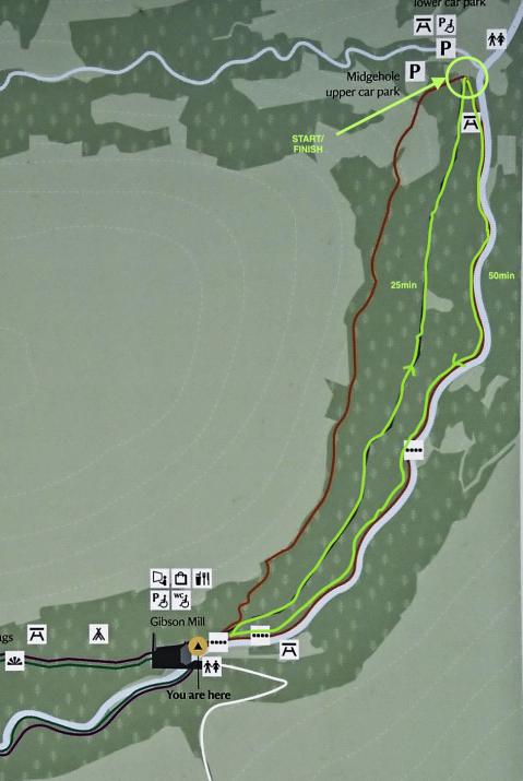
Parking: Car parking is available at either of the two car parks at the location shown on the route map. Car parking is free for National Trust members and £5 for non members. Outside of these car parks, the parking is very limited other than in Hebden Bridge itself which is about a 40min walk (1.5-2miles) down the road.
Getting to the car park:
From Hebden Bridge station go towards the town centre then turn right onto the A6033 Keighley Road. After about 1 mile, turn left onto the Midgehole Road. Continue along Midgehole Road until it meets the forest and the National Trust carpark is on the right.
The Walk:
 The entire route for this walk from the meeting point (marked "START/FINISH") is marked in light green via the riverside to Gibson Mill and back along the forest road to the car park. It is approximately 2-2.5 miles. The time to walk the route without stops is shown - about 50 minutes out to the mill and 25 min back, a total of 1hr 15 min. We will include ample opportunity for photo stops and refreshments/chat at Gibson Mill so this is more likely to be closer to 3hrs.
The walk is relatively flat with a few gentle inclines/declines and the occasional steps. Half of it is a riverside route with some uneven and rocky path following a steeper trail so a little care needs to be taken with footing, particularly after rain. There will be no climbing other than riverside stone and rooted steps on the first half. The route back to the start point will be by forest track with gentle inclines and declines.
Mobile phone coverage is intermittent given the geography of the walk (we will be in a valley) however we will not be more than 15 minutes from a point of communication.
